Skip to main content
Home
Historical Maps
World History
U.S. History
Canadian History
Canada (English)
Canada (Français)
Old School History Maps
Stories on the Map
Armenia
Assyria
Catalonia
Kurdistan
Palestine
Ukraine
Edmaps +
Historical Maps of Saudi Arabia
World
Europe
Middle East
Afghanistan
Assyria
Iran
Iraq
Israel & Palestine
Kurdistan
Lebanon
Saudi Arabia
Syria
Egypt
Asia
Latin America
Canada
U.S.A.
Australia
Map Collections and Atlases
Blank and Outline Maps of Saudi Arabia
(d-maps.com)
Saudi Arabia: Historical Maps Collection
(Library of Congress)
Historical Maps of Saudi Arabia
(American Geographical Society Library Digital Map Collection)
Historical Maps of Saudi Arabia
(David Rumsey Map Collection)
Oil Maps of the Middle East
(British Library)
Old Maps of Saudi Arabia
(oldmapsonline.org)
Maps
Arabia, 1818
(D. Lizars)
Arabia (with Egypt, Nubia and Abyssinia), 1843
Arabia, 1891
(D. Appleton)
Arabia, cca. 1900
(S. W. Zwemer)
Arabia, 1905-1923
(Joaquin de Salas Vara del Rey)
Asia Minor and Arabia, 1909
(William Patten)
Arabien, 1911
(in German; A. Stieler)
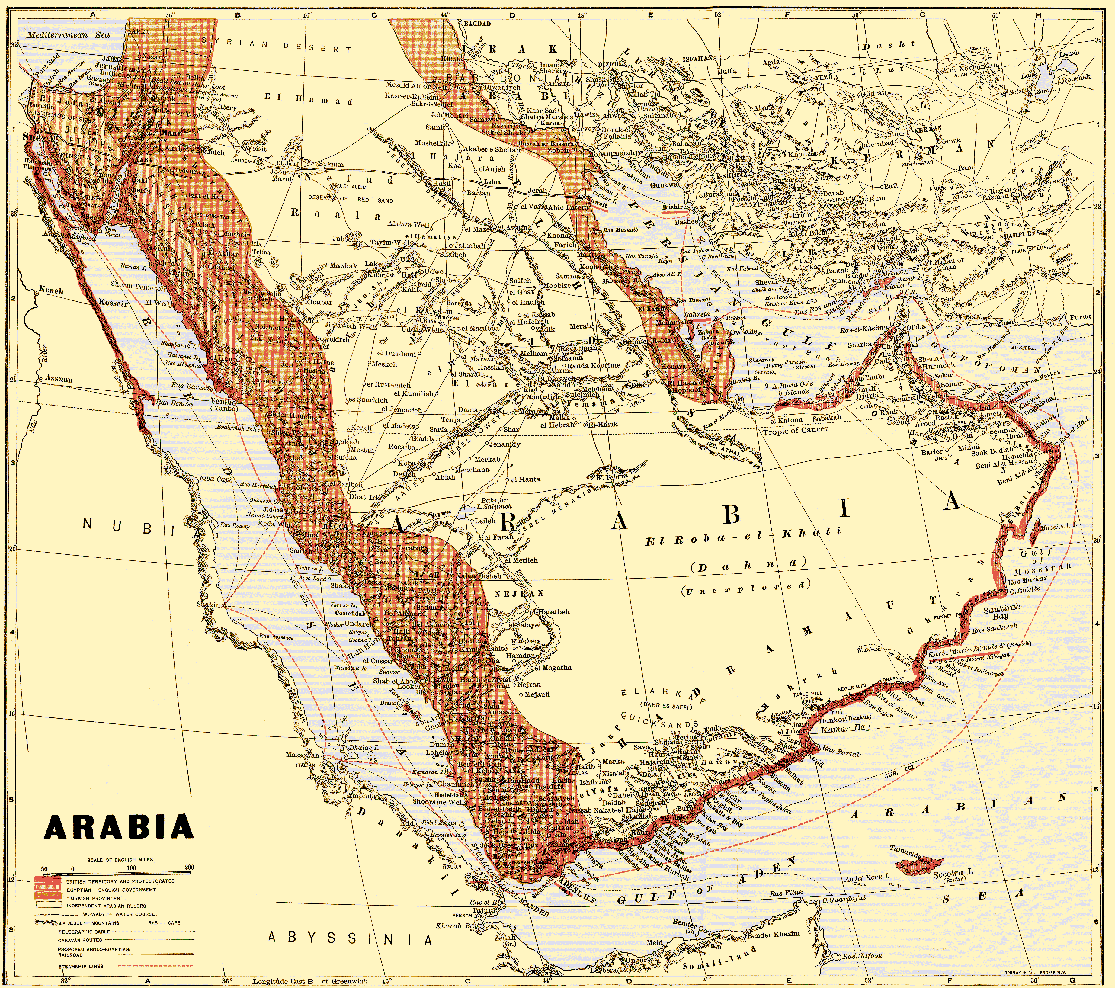
Arabia, Oman and Aden, 1913
(The Century Company)
The Islamic World Before 1914
Arabia showing the Kingdom of Hejaz, 1917
(C. S. Hammond and Co.)
Egypt and the Near East, 1918
(Daily Telegraph)
Arabian Peninsula:
Muslim Distribution Map, 1918
(in Italian; Ministero delle Colonie)
Arabia, 1929
(Touring Club Italiano)
Arabia, 1930
(C. S. Hammond and Co.)
Arabia and Bordering Near Eastern Countries, 1942
(Geographical Publishing Company)
Saudi Arabia & Other Middle East Countries, 1950
(U.S. Army)
Southern Arabia, 1957
(The Times Atlas)

