Skip to main content
Home
Historical Maps of USA
Historical Maps of Canada
Old School History Maps
EdMaps +
Historical Maps of Middle East
World
Europe
Middle East
Afghanistan
Assyria
Iran
Iraq
Israel & Palestine
Kurdistan
Lebanon
Saudi Arabia
Syria
Egypt
Asia
Latin America
Canada
U.S.A.
Australia
Map Collections and Atlases
Ancient Near East Site Maps
(The Oriental Institute)
Atlas of the Middle East
(CIA)
Historical Maps of the Middle East
(Perry-Castaneda Library)
Historical Maps of Middle East
(American Geographical Society Library Digital Map Collection)
Historical Maps of Middle East
(David Rumsey Map Collection)
Maps of the Islamic Middle East
(Princeton University)
Middle East Conflict: History in Maps
(BBC)
Middle East: Historical Maps Collection
(Library of Congress)
Middle East Map Collection
(University of Florida Digital Collections)
Middle East Maps
(Michael Izady)
Maps
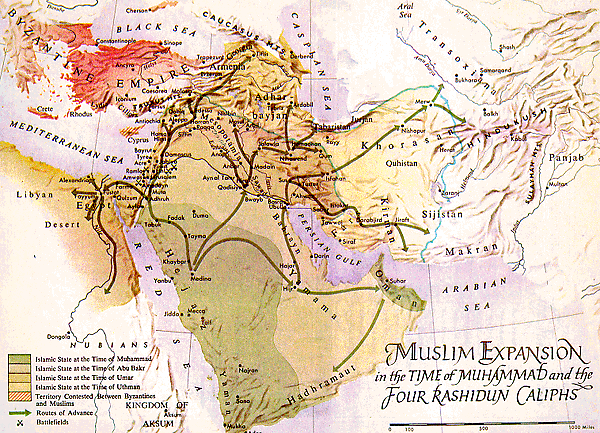
Muslim Expansion in the Time of Muhammad
(R. Roolvink et al., Historical Atlas of the Muslim Peoples, 1957)
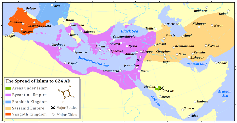
The Spread of Islam to 624 AD
Caliphate, c. 632-750 AD
The Spread off Islam to 733 AD
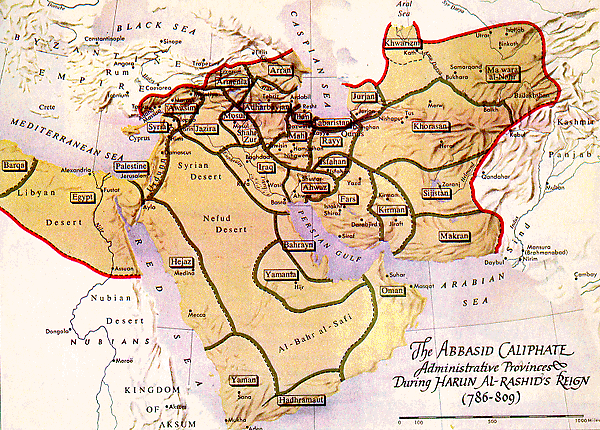
Western Asia under the Abbasid Caliphs (786)
(R. Lane Poole, Historical Atlas of Modern Europe, c.1900)
Abbaside Caliphate, 786-809
(R. Roolvink et al., Historical Atlas of the Muslim Peoples, 1957)
The Caliphate, circa 945
(Droysens Allgemeiner Historischer Handatlas, 1886)
Western Asia under the Mohammadan Dynasties, c. 970 and c. 1070
(R. Lane Poole, Historical Atlas..., c.1900)
Mediterranean Lands at the Time of the Crusades
(Droysens Allgemeiner Historischer Handatlas, 1886)
Western Asia at the time of Saladin, 1190
(Lane Poole, Historical Atlas of Modern Europe, c.1900)
Muslim Lands at the Ends of the 11th and 12th Centuries
(Droysens Allgemeiner Historischer Handatlas, 1886)
Western Asia at the time of Saladin, 1190
(Lane Poole, Historical Atlas of Modern Europe, c.1900)
The Muslim East in the First Half of the 13th Century
Western Asia under the Mongols, 1330
(R. Lane Poole, Historical Atlas of Modern Europe, c.1900)
Ottoman Empire at Fall of Constantinople 1453
Expansion of the Islamic World to 1500
The Muslim World around 1900
(S. Zwemer, The Moslem World, 1908(
The Muslim World, c. 1907
The Islamic World Before 1914
Middle East, 1906-1920
(Joaquin de Salas Vara del Rey)
Ottoman Levant (Syria, Aleppo, Beirut, etc.) before 1914: Administrative division
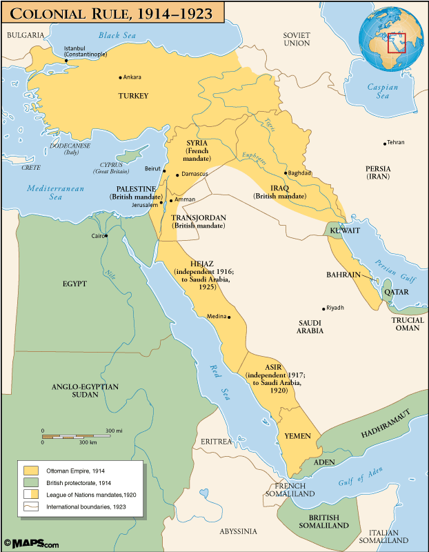
Middle East: Colonial Rule, 1914-1923
(maps101.com)
Middle East, 1918-1940
Asie occidentale, 1920
The Middle East from the Treaty of Sèvres (1920) to the Treaty of Lausanne (1923)
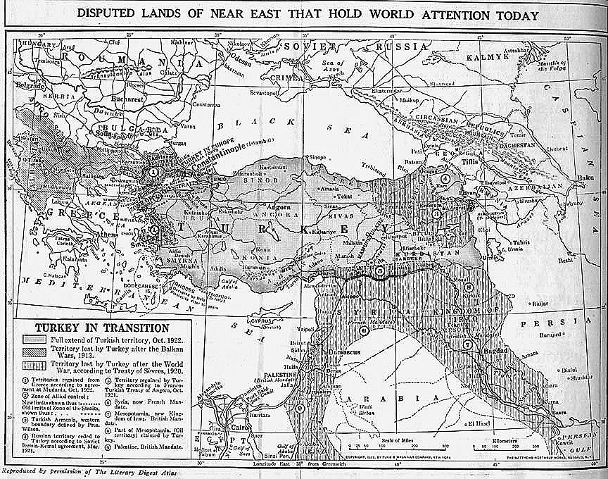
Disputed Lands of Near East that Hold World Attention Today
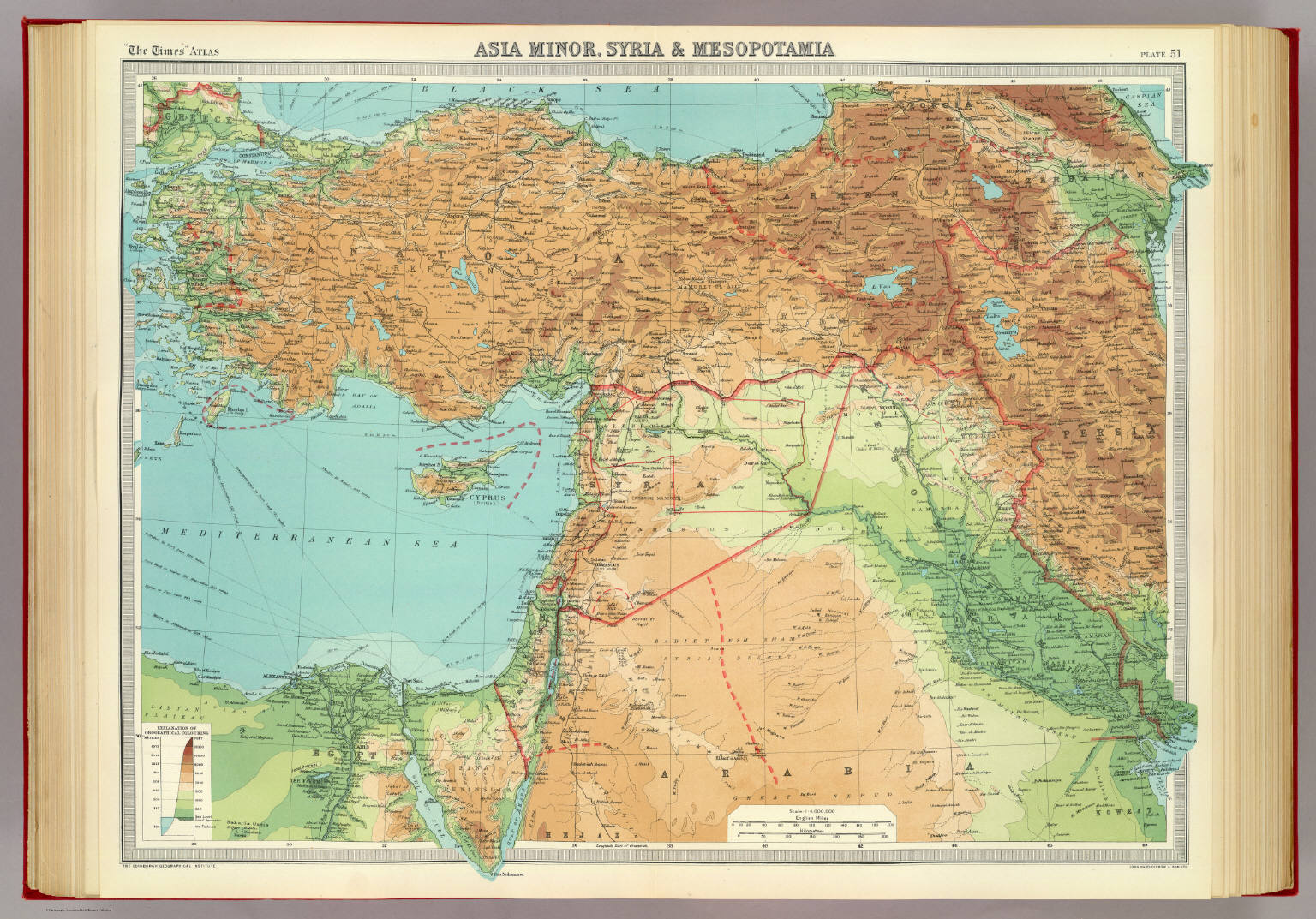
Asia Minor, Syria and Mesopotamia, 1922
(The Times Atlas, 1922)
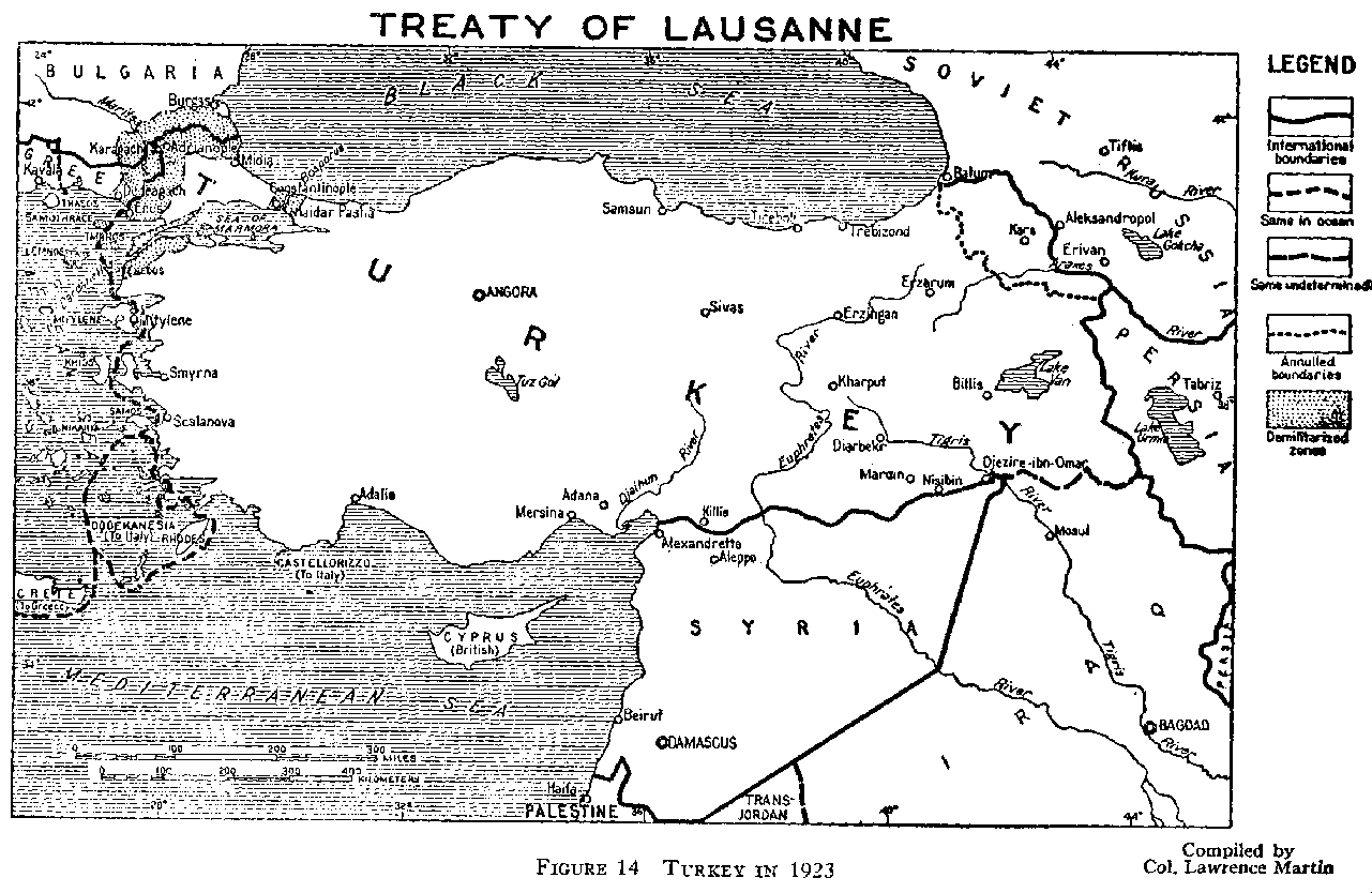
Treaty of Lausanne (1923)
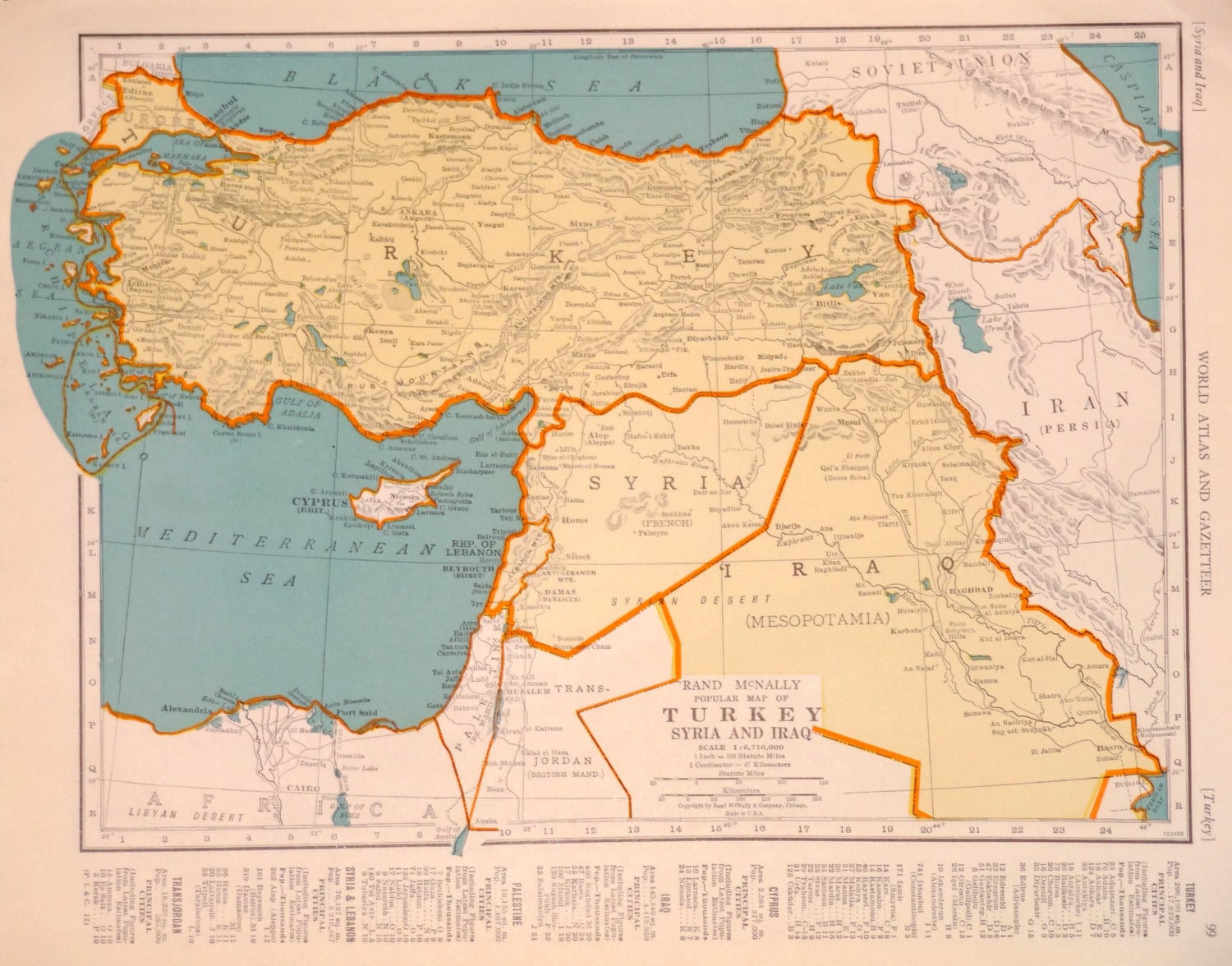
Rand McNally Popular Map of Turkey, Syria and Iraq, 1940
Distribution of Muslim Population by Country and Territory, 2009
Robin Wright’s Remapping of the Middle East
Ralph Peters’ Remapping of the Middle East

