Skip to main content
Home
Historical Maps
World History
U.S. History
Canadian History
Canada (English)
Canada (Français)
Old School History Maps
Stories on the Map
Armenia
Assyria
Catalonia
Kurdistan
Palestine
Ukraine
Edmaps +
Historical Maps of Kurdistan
World
Europe
Middle East
Afghanistan
Assyria
Iran
Iraq
Israel & Palestine
Kurdistan
Lebanon
Saudi Arabia
Syria
Egypt
Asia
Latin America
Canada
U.S.A.
Australia
Map Collections and Atlases
Atlas of the Middle East
(CIA)
Historical Maps of the Middle East
(Perry-Castaneda Library)
Middle East Maps
(Israeli-Palestinian ProCon.org)
Explore Iraqi Kurdistan Map, History, and News
(The Kurdish Project)
Genocide in Iraq: The Anfal Campaign against the Kurds, 1993
(rightsmaps.com)
Historical Maps of Kurdistan
(American Geographical Society Library Digital Map Collection)
Historical Maps of Kurdistan
(David Rumsey Map Collection)
Kurdistan: Historical Maps Collection
(Library of Congress)
Kurdistan in Old Maps
(Kurdistan Chronicle)
"Kurdistan" in the maps of the Middle East between the years 1432 and 1925
(geo-strategic.com)
Kurdistan: Map Archive
(Kurds NGO)
Kurdistan’s Maps
(saradistribution.com)
Old maps of Iraqi Kurdistan
(oldmapsonline.org)
Maps
Kurdistan Map
(The Kurdish Project)
Kurdistan, 1892
(F. R. Maunsell)
Ethnographical Map of Eastern Turkey, 1910
(Royal Geographical Society)
Ottoman Empire, 1916
(in German; Dietrich Reimer)
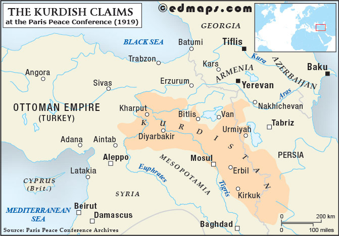
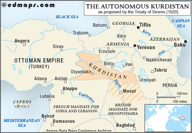
Turkish Kurdistan, 1920
(as proposed by the Treaty of Sevres)
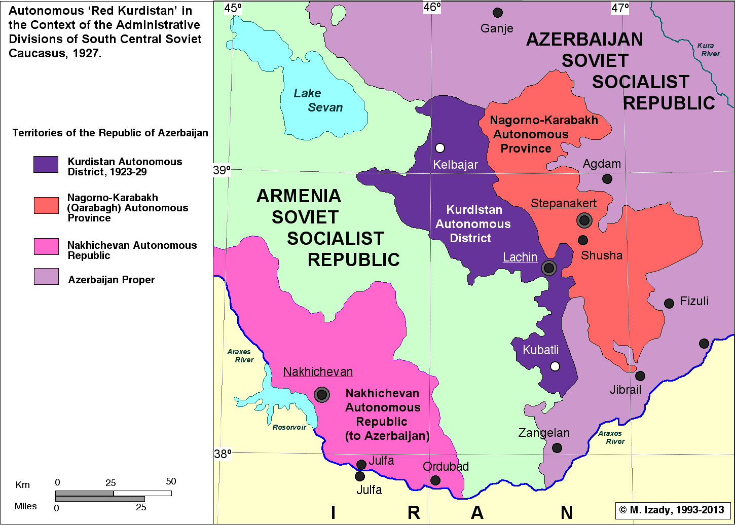
Soviet Kurdish Autonomous District (Red Kurdistan). 1923-1929
(M. Izady)
Kurdish Tribal Map of Iraq, 1944
(Yale University Library Digital Collections)
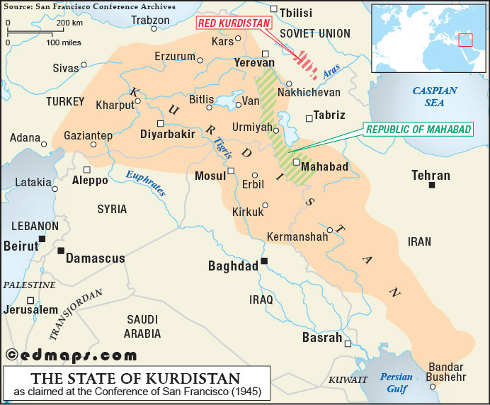
Kurdistan, 1945
(Conference of San Francisco)
Kurdistan et groupements kurdes isolés, 1947
Iraqi Kurds - Kurdistan Region and Kurdish Territorial Demands
Iraqi Kurdistan - Area inhabited by Kurds
Map of Mainly Kurdish Settled Region
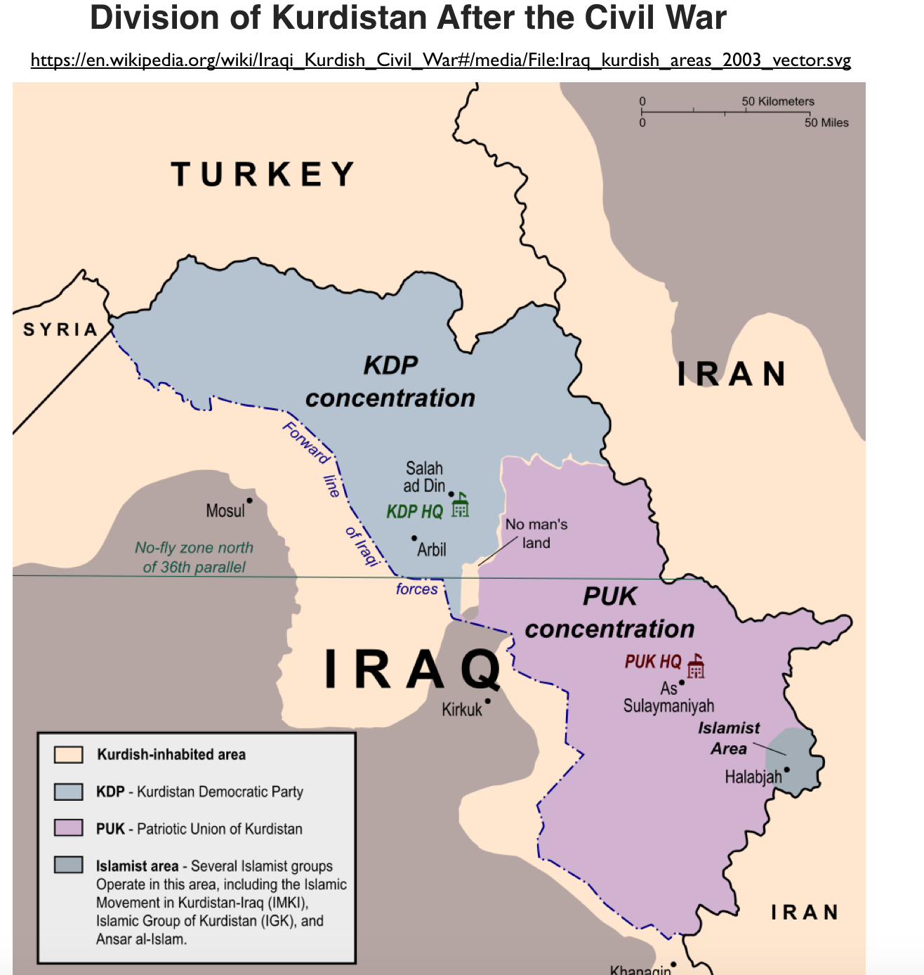
Division of Kurdistan after the Civil War, 2003
Kurdistan Regional Government Map, 2005
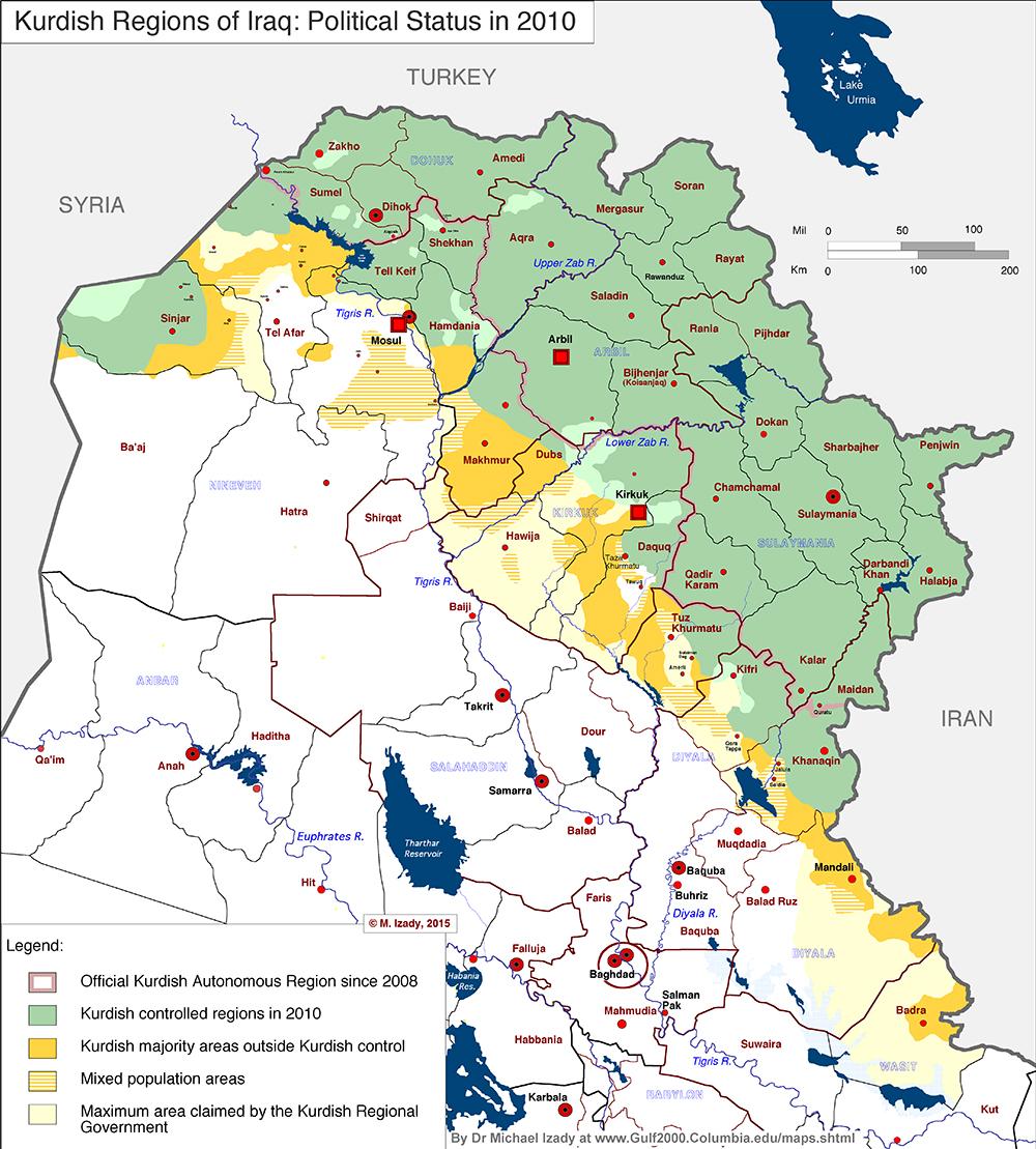
Kurdish Regions of Iraq: Political Status in 2010
Kurdistan Region Exploration Activities Map, 2013
Kurdistan Regional Govt. Energy Projects, 2013
(stratfor)
Kurdish-Controlled Region, cca. 2015
Iraq: Kurdistan Region, 2021
(UNCHR)
See Also: KURDISTAN IN SEVEN MAPS

