Skip to main content
Home
Historical Maps
World History
U.S. History
Canadian History
Canada (English)
Canada (Français)
Old School History Maps
Stories on the Map
Armenia
Assyria
Catalonia
Kurdistan
Palestine
Ukraine
Edmaps +
Historical Maps of Afghanistan
World
Europe
Middle East
Afghanistan
Assyria
Iran
Iraq
Israel & Palestine
Kurdistan
Lebanon
Saudi Arabia
Syria
Egypt
Asia
Latin America
Canada
U.S.A.
Australia
Map Collections and Atlases
Blank and Outline Maps of Afghanistan
(d-maps.com)
Afghanistan: Historical Maps Collection
(Library of Congress)
Afghanistan Maps
(Perry-Castañeda Library Map Collection)
Historical Maps of Afghanistan
(American Geographical Society Library Digital Map Collection)
Historical Maps of Afghanistan
(David Rumsey Map Collection)
Old Maps of Afghanistan
(oldmapsonline.org)
10 maps to understand Afghanistan, 2021
(al-Jazeera)
Maps
Central Asia, 1844
(John Arrowsmith)
Afghanistan and the adjacent countries, 1844
(East India Company)
Persia, Arabia and Co., 1848
(Samuel Mitchell)
Persia and Afghanistan, 1854
(Adam and Charles Black)
Persia and Kabul, 1864
(James Wyld)
Military staff map of Central Asia and Afghanistan, 1879
(James Wyld)
Persia, Afghanistan and Baluchistan, 1904
(Americana Co.))
Persia, Afghanistan and Baluchistan, 1912
(Rand McNally Co.)
Afghanistan and its Neighboring Countries, 1914
(Flemming Verlag; in German)
Ethnographical Map of Afghanistan, 1921
(British Library)
South-Western Asia, 1922
(J. G. Bartholomew)
Iran and Afghanistan, 1945
(in Russian)
Afghanistan: Pushtun Territory, 1979
(CIA)
Afghanistan: The Ethnolinguistic Groups, 1992
(CIA)
Afghanistan: Ethnic Map, 2000
(Le monde diplomatique)
Afghanistan: Administrative Divisions, 2008
(CIA)
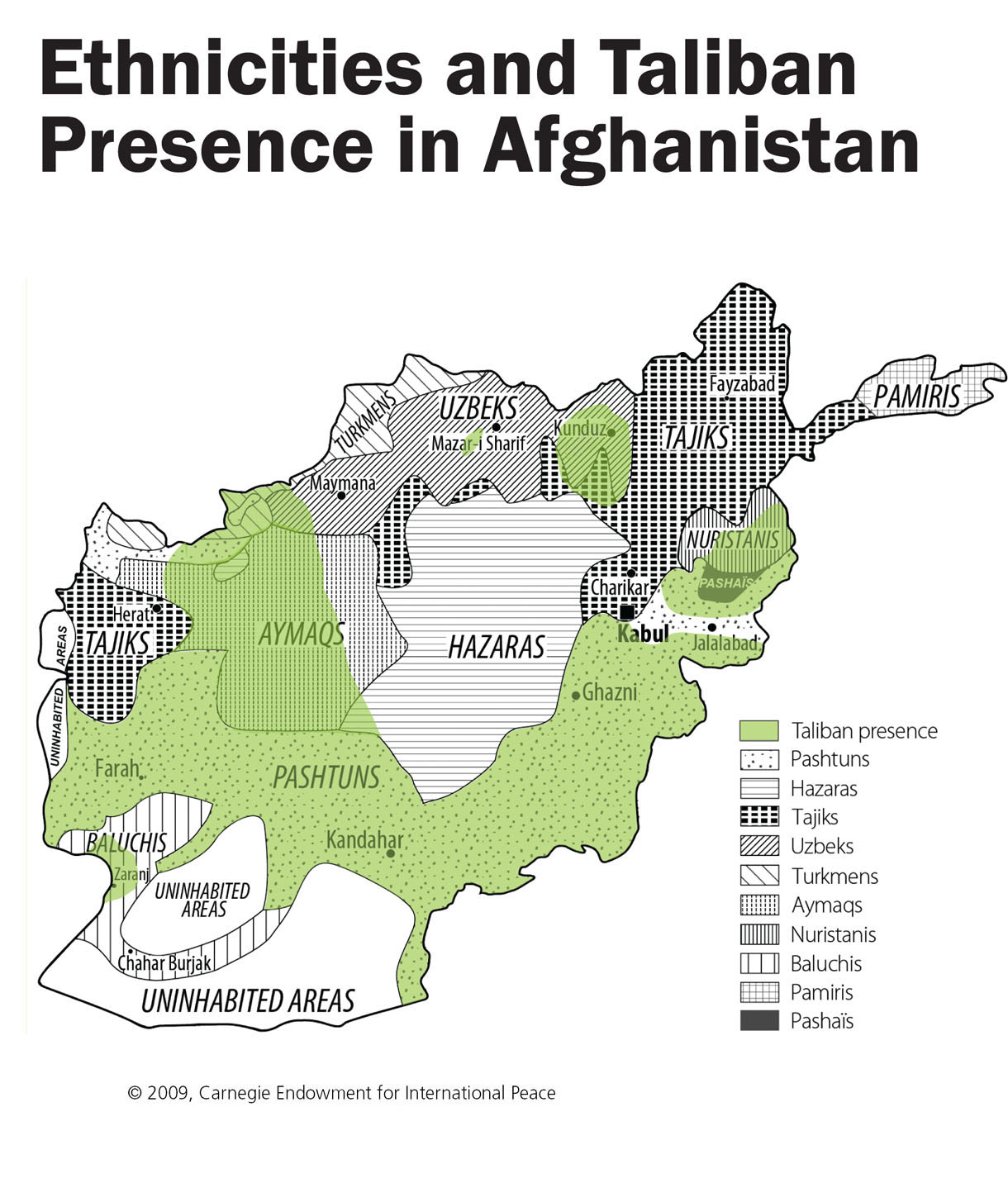
Ethnicities and Taliban Presence in Afghanistan, 2009
(Carnegie Endowment for International Peace)
Afghanistan: Provinces and Districts, 2012
(CIA)
Afghanistan and Pakistan: Ethnic Groups
(National Geographic)

