Skip to main content
Home
Historical Maps
World History
U.S. History
Canadian History
Canada (English)
Canada (Français)
Old School History Maps
Stories on the Map
Armenia
Assyria
Catalonia
Kurdistan
Palestine
Ukraine
Edmaps +
Historical Maps of Assyria
World
Europe
Middle East
Afghanistan
Assyria
Iran
Iraq
Israel & Palestine
Kurdistan
Lebanon
Saudi Arabia
Syria
Egypt
Asia
Latin America
Canada
U.S.A.
Australia
Map Collections and Atlases
Assyria Maps
(atour.com)
Assyrian Maps
(Assyrian International News Agency)
Atlas of the Middle East
(CIA)
Historical Maps of the Middle East
(Perry-Castaneda Library)
Historical Maps of Assyria
(American Geographical Society Library Digital Map Collection)
Middle East Maps
(Israeli-Palestinian ProCon.org)
Maps
Map showing the country of the Assyrian Christians
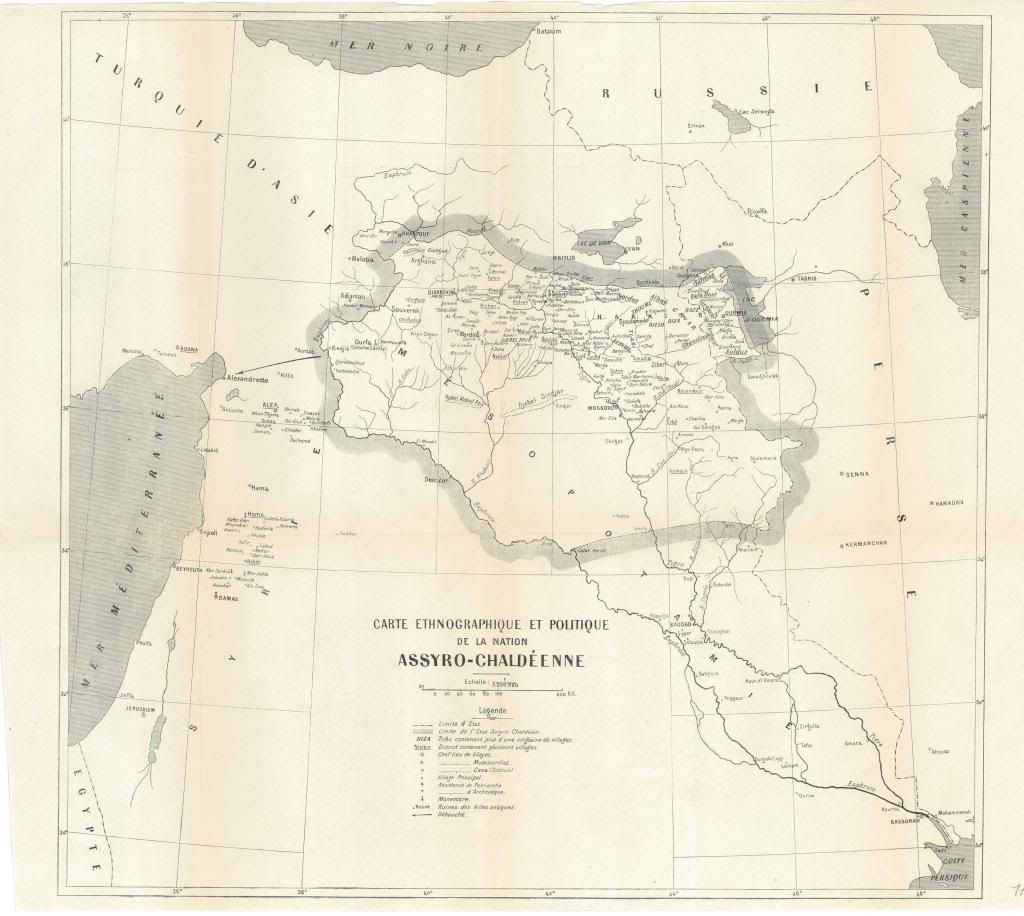
Assyria, 1919: Carte ethnographique et politique de la nation assyro-chaldéenne
Proposed Assyrian Administrative Region
(Assyrian International News Agency)
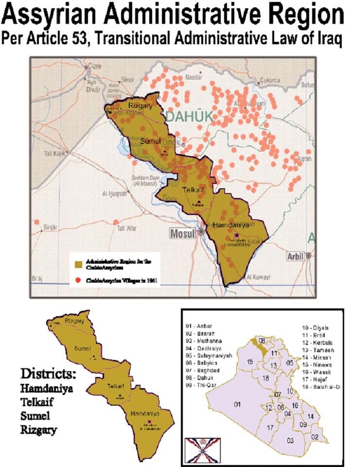
Assyrian Administrative Region
(as defined by Art. 53, Transitional Administrative Law of Iraq)
Demographic distribution of the Chaldeans, the Syriacs and the Assyrians in Northern Iraq
Iraq: Map of Assyrian villages in North Iraq (1961)
Iran: 115 Assyrian villages in Urmia
Syria: 35 Assyrian villages on the Khabur River Region
See also: ASSYRIA IN SIX MAPS

